
|
|
On-Line User Manual
MyEarth v1.0 goes further to support search and retrieval of hdf4 and ESRI shapefile content which is visualized in a VG, by means of KML documents (which are dynamically generated at the time of query). The tool not only identifies the spatial extent {maxLat, minLon, minLat, maxLon} of the ROI on the Earth's surface, but allows spatial searches to match a variety of common shapes {linestring, point, MBR, polygon}. As a convenience, any ROI may be saved for future searches. In this way, MyEarth becomes a fully extensible archive, search and retrieval tool for a wide variety of large 4d datasets that may be visualized in a VG.
The next sections of this guide follow. Section 2 helps you get started and discusses the systems requirements, licensing and installation. Section 3 describes the Search and Retrieval Tool, providing a step by step introduction to the main functions and menus, and takes you through the search and advanced search menus, discussing how to set search criteria in each of the attribute selection panels, which are also illustrated in the section. It also discusses the types of data files that MyEarth uses and how to explore and manipulate the retrieved data. Section 4 discusses the functions necessary to perform ingest and archive of user provided data sets. Section 5 discusses how to use MyEarthAdmin, including working with SSE(Spatial Search Engine) and the IE(Ingest Engine).
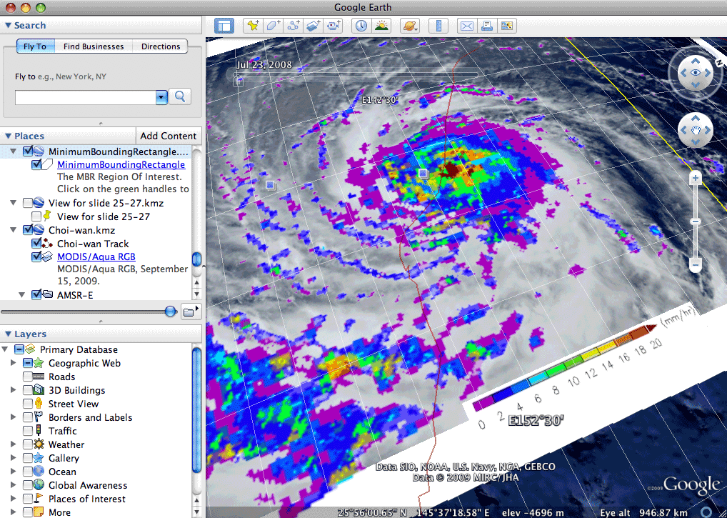
Figure 1 – The MyEarth™ v1.0 Search and Retrieval Tool on Google Earth™, showing a retrieval of a MODIS data set. User defines the search criteria, in terms of a Region of Interest (ROI) through the search form, or directly via the Google Earth Visualization System which are submitted to a spatial search engine (SSE) which performs the spatial search to retrieve information about the MODIS radiances, and performs a spatial JOIN query to retrieve related browse information from the archive, for display directly with Google Earth.
 |
Section 1
Introduction |
Section 2
Getting Started |
Section 3
MyEarth Search and Retrieval Tool |
Section 4
Ingesting Data Sets |
Section 5
Using MyEarthAdmin |