
|
|
MyEarth Search and Retrieval ToolThe MyEarth Search and Retrieval Tool enables users to ingest (IE) and search data that is archived in a spatial search engine (SSE) database, and then to retrieve the results directly on to a Virtual Globe (VG) Visualization System, such as Google Earth. Users of spatial search and retrieval systems normally define a Region of Interest (ROI) by entering textual information, via a form, which interprets the regional information to return the search results into a list of files {filename, timerange, filetypes available} which match the search criteria provided in the search form. While MyEarth possesses the familiar search entry form, it also allows user interaction with the VG, in terms of manipulating the ROI directly. Following execution of a spatial query, the results are displayed within the search ROI for immediate analysis. |
 |
MyEarth comprises Ingest Engine (IE) and Spatial Search Engine (SSE) functionsThe Ingest (IE) function allows large numbers of data sets to be archived, for retrieval, on-demand at a future time. The Spatial Search Engine (SSE) database is updated at the time of data ingest whereby spatial, temporal and textual information describing the data set is registered in the database and becomes searchable. The MyEarth Search Form is the starting point for specifying a spatial search. Users can then specify their preferences for the type of search by means of the MyEarth Preferences menu, choosing one of either {MBR, Polygon, LineString, Point}. Users can then choose either a basic Search form or an Advanced Search form to further define the search criteria. Alternatively MyEarth, also allows user interaction with the VG, in terms of manipulating the ROI directly, by moving the points defining a polygon region and saving the resultant ROI, hence enhancing the ability to define the search region in 3D space anywhere over the Earth. |
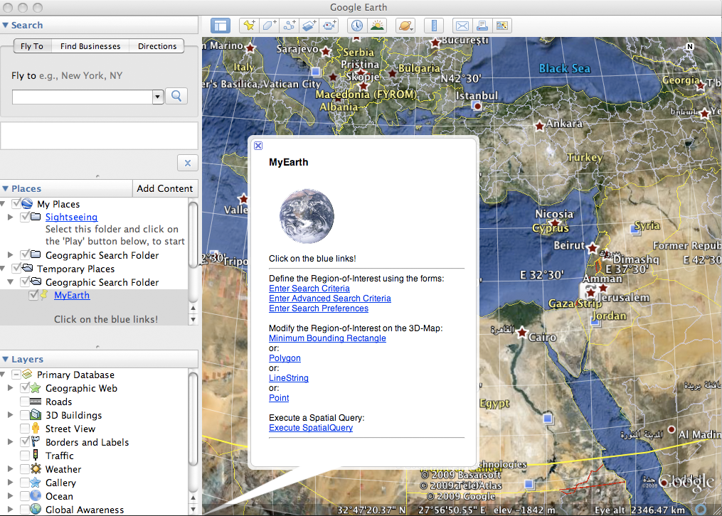 |
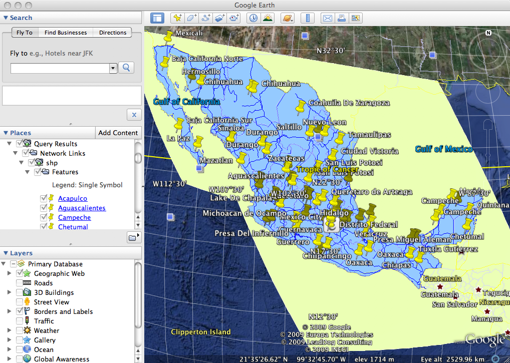
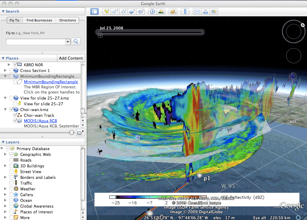
The Region of Interest (ROI) may be manipulated directly within the Virtual Globe (VG) visualization environmentThe Region of Interest marks out the overall area within which the data sets are to be searched. The ROI may be specified via direct manipulation of the default Minimum Bounding Rectangle, or optional polygon, linestring, or point, via the Google Earth main window, or by means of the MyEarth Search, or Advanced Search menus, which allow spatial, temporal and textual information defining the search criteria to be entered via a browser form.When users specify a ROI which contains rich data sets, the MyEarth Search and Retrieval Tool interprets that search request and extracts the location of those data sets directly from the archive and retrieves browse image representations of the matched data sets for display instantaneously within the VG environment. |
 |
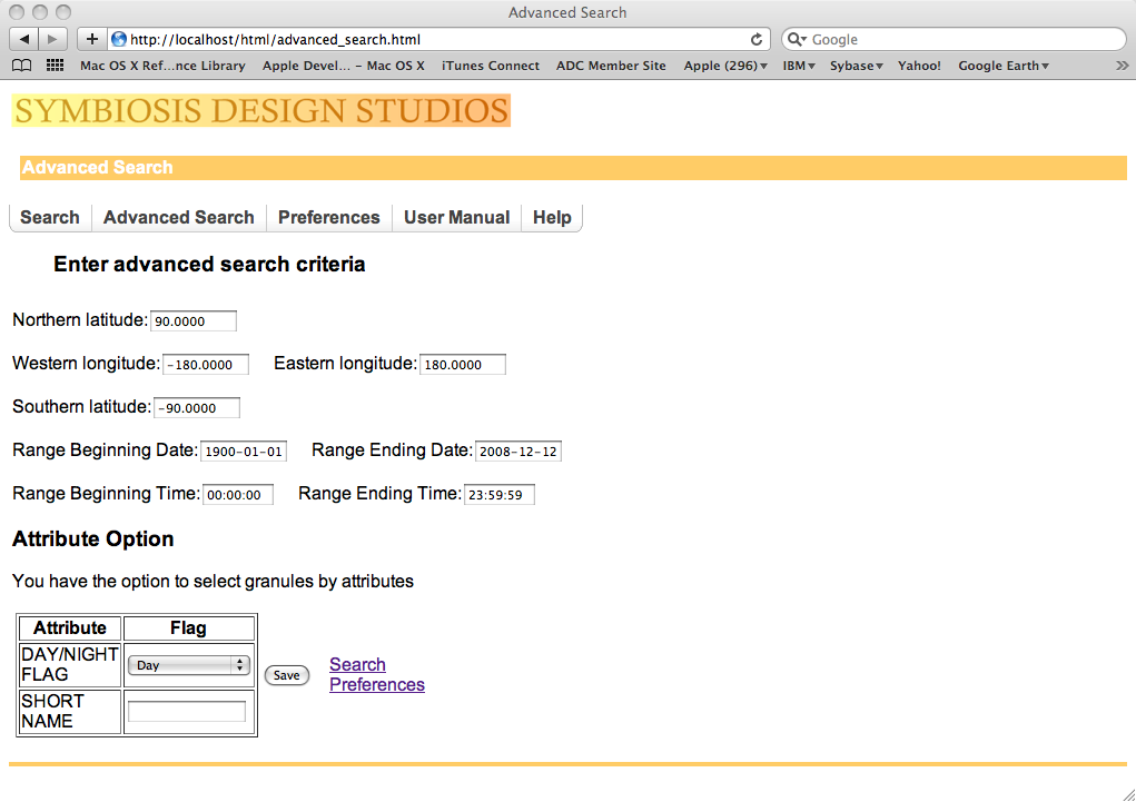
Alternatively, Search criteria may be entered via a traditional formIf the user chooses to specify the search criteria via the Advanced Search menu, then a more detailed list of searchable parameters is selectable. Users can define spatial search criteria in terms of: Northern Latitude, Western Longitude, Eastern Longitude, Southern Latitude and define temporal search criteria in terms of: Range Beginning Time, Range Beginning Date, Range Ending Time, Range Ending Date, and additional attributes such as: ShortName, Day/Night Flag, and others as available.MyEarth v1.0 currently supports search and retrieval of hdf4 and ESRI shapefile content, and their associated browse images, which may be visualized in a VG. |
 |
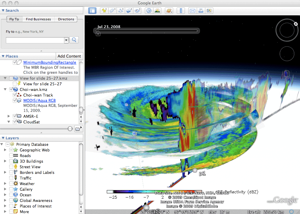
Search Results from a spatial query are displayed directly within the VG environmentUser defines the search criteria, in terms of a Region of Interest (ROI) through the search form, or directly via the Google Earth Visualization System, which are submitted to a spatial search engine (SSE) which in turn performs the spatial search to retrieve information about the matching data sets, for example CALIPSO radiances, by performing a spatial JOIN query to retrieve related browse information from the archive, for immediate display within the Google Earth VG environment.MyEarth allows spatial searches to match a variety of common shapes: {linestring, point, MBR, polygon}. As a convenience, any ROI may be saved for future searches. In this way, MyEarth™ becomes a fully extensible ingest, archive, search and retrieval tool for use with a wide variety of large 4d datasets that may be visualized in a VG. |
 |
MyEarth v1.0 is designed for Mac OS XMyEarth v1.0 is a Search and Retrieval Tool designed specifically for the Mac OS X™ operating system and stand-alone installations of the Google Earth™ Virtual Globe (VG). Other versions are in development, including PC, UNIX, mobile applications and other VGs.MyEarth v1.0 is available now for both Mac OS X 10.5 and 10.6 platforms (Intel and PowerPC). A licensed copy of Google Earth 4.x or 5.x must also be installed. more Contact Symbiosis Design Studios for more information about MyEarth, or to specify your data search and retrieval needs. |
| Home Products Services About Contact Us |
|
All material ©2010 by Symbiosis Design Studios, Ltd. - All rights reserved.
|
|
|